
The red trail is a part of the Main Trail in Beskidy. The route begins near the railway station in Rabka, then passes through the city centre, the health resort and the sanatorium. This is where the route goes past the green and the yellow trails. The red trail leads you out of town and gently climbs the peak called the Tartów (710 m) with a nice panorama of Rabka Zdrój. This is where the tougher approach to the summit of Maciejowa (815 m) begins - there are ski lifts and the route meets the black trail again (which can take you back to Rabka-Zdrój). In the nearby Przysłop clearing there is a PTTK mountain shelter, where you can relax before continuing your ascend, as well as admire the panorama of the Babia Góra Mountain, the Tatras and the Podhale region. Further on, the trail leads through the forests of the Jaworzyna Ponicka (995 m) and the Pośrednia Pass (it meets the yellow trail here) to the Stare Wierchy, where a PTTK shelter is situated. It is an important junction of tourist trails, e.g. the blue trail, the green trail (this one will take you to Nowy Targ-Kowaniec) and the yellow trail (to Olszówka). The red trail leads further on through the summit of Groników (1027 m) to the Obidowiec (1106 m; from there the green trail leads to Koninki), to the edge of the Gorce National Park. Further on, the trail goes in the south-east direction up to the Turbacz (1310 m) - the highest peak of the Gorce Mountains, and even further to the Władysław Orkan PTTK hostel.
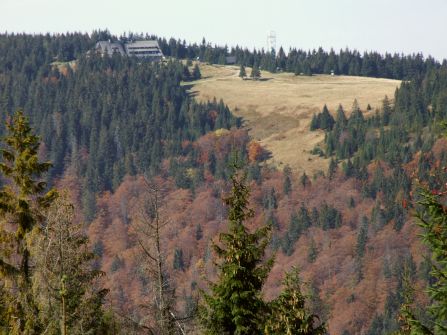
Turbacz - the highest peak of the Gorce Mountains, located in the centre of the ridge and forming a huge massif. According to most sources, its height amounts to 1310 m above sea level (some sources claim it’s 1315 m). It is composed of flysch.
Seven different mountain ridges extend from the Turbacz in the following directions:
• the Range of the Gorce Mountains, going eastward; From the ridge, the Kiczor to be precise, extends a side ridge, which goes through the Knurowska Pass and forms the long Lubań range
• the Mostownica and Kudłoń Ridges in the north-east direction
• the Turbaczyk Ridge in the northern direction
• the Suchy Groń Ridge in the north-west direction
• the Obidowiec Ridge extending west to the Sieniawska Pass
• the Średni Wierch Ridge, also in the western direction
• the Bukowina Obidowska Ridge in the south-west direction. The Bukowina Waksmundzka Ridge extends from it.
The Turbacz peak itself lies outside the Gorce National Park, whose boundary is slightly to the west and the north of the summit.

 PL
PL EN
EN DE
DE